Agronomy & Farm Business planning
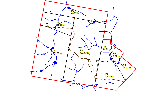
FARM MAPPING
Comprehensive farm maps are essential management tools.
We prepare high resolution farm maps that highlight relevant features. The information mapped includes paddock names, troughs, creeks and waterways, roads, gates, stock yards and buildings. Maps can include production zones, soil types, weed infestations, arable and non-arable parts of paddocks. Once mapped, various combinations of this information can be presented on different layers. Map files can also be exported for use in other mapping programs.
Farm maps are important to allow improvement of productivity as well as assisting day to day management. To be useful, maps need to show paddock size in hectares. A fertilizer spreading contractor will need productive hectares, but a crop spraying or crop/pasture sowing contractor will require a map showing the arable hectares. Each will need to know where the creek crossings, tracks and gates are located.
The maps below show a 395 Ha farm before (top) and after paddocks are re-organized. The outcome of the change was more efficient management of stock plus better use of water and pastures.